This document proposes a new National Security and Border Protection System designed for the Argentine Republic. It integrates state-of-the-art technologies such as anti-drone radars, high-definition surveillance cameras with artificial intelligence, jamming systems, secure satellite communications, and early radioactive detection domes.
- Strengthen national defense and sovereignty.
- Monitor and protect borders with cutting-edge technologies.
- Prevent illegal activities such as drug trafficking, human trafficking, and smuggling.
- Ensure early detection of aerial and environmental threats.
- Modernize national security infrastructure in remote and strategic areas.
- Anti-drone radar systems: Detection, tracking, and neutralization of unauthorized drones across national borders.
- High-definition surveillance cameras: Equipped with artificial intelligence for facial and movement recognition, with 24/7 remote access.
- Jammers: Disruption of communications and GPS of hostile devices.
- Communication systems: Secure and redundant networks via satellite, VHF, UHF, and LTE.
- Early radioactive detection domes: Sensors and alarms for identifying radioactive material transit or anomalies in border areas.
Strategic deployment across:
- North and Northwest borders (Salta, Jujuy, Formosa, Misiones).
- Patagonian zones and international crossings in Neuquén, Chubut, and Santa Cruz.
- Coastal surveillance along the Paraná-Paraguay Waterway and Atlantic coastline.
- Key national infrastructure (dams, energy nodes, communications centers).
- Improved real-time national security monitoring capacity.
- Support to armed and security forces in operational decision-making.
- Reduction of illicit border and aerial activities.
- Technological autonomy and resilience in extreme situations.
- Data integration with national intelligence systems.
- Power supply in remote areas (solar panels, wind turbines, hybrid systems).
- Secure satellite communication terminals.
- Control centers with encrypted access.
- Servers and cloud storage with national cybersecurity standards.
- Training centers for technical and operational staff.
This project represents a strategic investment in Argentina’s future, combining technology, sovereignty, and security. It enables the country to face the new challenges of 21st-century national defense with robust and scalable infrastructure.
Our Team: U.S. Army Special Forces Experts
1.1 Description and Necessity
Early detection of radioactive materials is crucial for national security, especially in combating organized crime, nuclear terrorism, and radioactive material smuggling. Detection domes will be strategically placed at borders, ports, airports, and critical facilities to ensure any suspicious gamma or neutron activity is identified and addressed promptly.
These domes will include advanced sensors that constantly monitor the presence of radioactive particles—particularly gamma rays and neutrons. Below are the key components:
Gamma Ray Detectors
- Operating Principle: Based on ionization, where gamma rays interact with materials like cesium iodide or sodium iodide, releasing electrons that generate measurable signals.
- Technical Specs:
• NaI(Tl) or CZT sensors for high spectral resolution.
• Energy range: 30 keV to 3 MeV.
• Spectral resolution: <7% at 662 keV (Cs-137 peak).
• Sensitivity: Detects low gamma radiation levels (μSv/h or nSv/h) for continuous monitoring.
Neutron Detectors
- Operating Principle: Use of He-3 activation, boron, or phosphorus scintillators to detect neutron interactions.
- Technical Specs:
• He-3: High thermal neutron detection efficiency.
• Phosphor-based (LiF): Suitable for fast neutron detection.
• Sensitivity range: 0.1 nSv/h and above.
• Fast response time: <10 seconds to detect significant neutron release.
- Sensor Redundancy: Multiple redundant sensors per dome ensure continuous and reliable coverage, all linked to a secure communications network.
- Real-Time Analysis: Sensor data will be analyzed in real time using advanced algorithms to identify unusual or hazardous radiation sources and trigger automatic alerts for rapid intervention.
Strategic Locations
- Borders: To detect illegal trafficking of radioactive materials.
- Airports & Seaports: At cargo and passenger terminals to monitor transported radioactive goods.
- Energy and Research Facilities: To protect critical infrastructure.
Energy Autonomy
Domes will be equipped with autonomous power systems including solar panels and backup batteries to ensure continuous operation without grid dependency.
Secure Communications Network
Domes will transmit data in real time via encrypted communication to a central control center, ensuring confidentiality and data integrity.
Remote Monitoring
Operators can access sensor data remotely via centralized software with advanced visualization and analytics for fast, effective decision-making.
- Multichannel Detection: Detects gamma rays, neutrons, and alpha/beta particles in a single device to enhance monitoring accuracy.
- AI for Predictive Analysis: AI algorithms will detect anomalies and forecast radiation patterns before they become critical threats.
- Automatic Alerts: The system will automatically notify law enforcement, military, or emergency response teams in case of high radiation levels.
2.1 Rapid Response Network
- Specialized Teams: Activation of rapid response units like the Nuclear Brigade and Chemical-Biological Response Teams in case of threat detection.
- Safety Protocols: Clear procedures for safe evacuation, containment, and neutralization of radioactive materials.
2.2 Continuous Personnel Training
- Technical Training: Ongoing training for security staff, border authorities, and operators in radiation emergency response.
- Simulations: Regular emergency drills to evaluate response capabilities.
The radiation detection domes will fully integrate with the broader national security system—including high-resolution cameras, anti-drone radars, jammers, and border surveillance infrastructure. This ensures coordinated automatic responses against illegal activities or radioactive threats using advanced national technology.
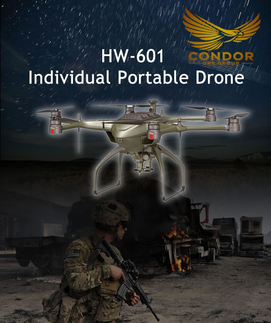
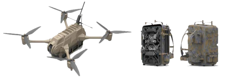
HW-601 Individual Portable Drone
A Tactical and Versatile UAV for Complex Missions
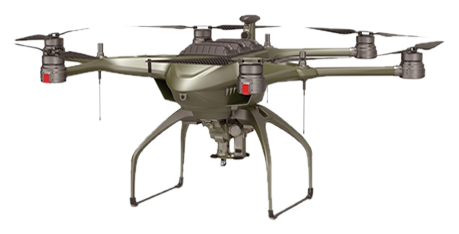
• Compact, foldable structure
• Ready to deploy in under 2 minutes
• Designed for rugged and extreme weather environments
• Highly portable with tactical backpack
• Max Load: 8 kg
• Battery Life: 50 mins
• Flight Radius: 15 km
• Max Altitude: 5000 m
• Speed: < 20 m/s
• Operating Temp: -40 to +85 °C
• IP55 Protection
• Wind Resistance: Level 6
• Integrated Beidou, GPS, GLONASS, RTK
• Horizontal Precision: ±0.02 m
• Vertical Precision: ±0.05 m
• Day/Night Reconnaissance
• Laser Targeting
• 3D Terrain Mapping
• Real-time Combat Integration
• Supports single or swarm missions
• Folds down to 800 mm
• Lightweight & Easy to carry
• Tray storage + tactical backpack
• Military reconnaissance
• Border patrol
• Disaster response
• Search & rescue
• Tactical surveillance
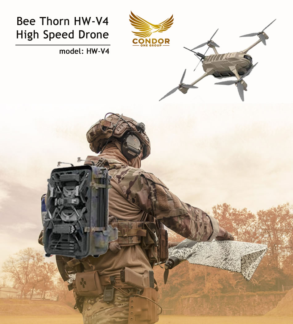
Bee Thorn HW-V4 High Speed Drone
model HW-V4
– Carbon fiber composite structure (integrated molding)
– Lightweight body with high strength and stiffness
– Fast deployment (under 2 minutes)
– Portable with tactical backpack
– Body Size: 376 mm × 446 mm × 116 mm (including battery)
– Weight: 1.8 kg
– Control Distance: < 3 km
– Flight Speed: 44.4 m/s
– Battery Life: 30 minutes
– Operating Temperature: -40 °C to +85 °C
– Effective Load Capacity: ≤ 500 g
– Assembly/Disassembly Time: < 2 minutes
– Carbon fiber material: integrated molding, lightweight body, high strength and stiffness
– Strong portability, fast flight speed, and easy installation
– Wide-angle and telephoto dual lens design
– Wider field of view and precise first-person VR control
The Bee Thorn HW-V4 high-speed unmanned aerial vehicle adopts a quadcopter structure for flight power and is mainly used for rapid target tracking.
It is equipped with ultra-low latency dual visual lenses (wide-angle and telephoto), enabling the UAV to search, recognize, and track targets in real time. It provides a broader field of view and longer-distance video transmission for better image data capture.
With high-precision navigation, compact dimensions, and strong portability, the HW-V4 can be easily carried in a tactical backpack and deployed rapidly. It supports both single-player operation and swarm deployment scenarios.
A single remote control can manage multiple drones of the same model, making it ideal for fast-paced missions in urban, mountainous, or complex terrains.
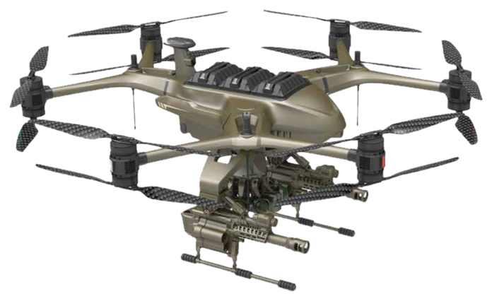
Tomahawk H16-V12 Model: H16–V12
- Body size: 1530mm × 1750mm × 830mm
- Aircraft wheelbase: 1650mm
- Battery life: ≥ 60 minutes
- Maximum load: < 25kg
- Flight radius: ≤ 15km
- Operating temperature: -40 ℃ ~ +85 ℃
- Disassembly and assembly time: < 2 minutes
- Power battery: 30000mAh
- Flight speed: ≥ 18m/s
- Flight altitude: ≤ 5800m
- Practical ceiling: 4500m
- Wind resistance level: 7
- Protection level: IP55
- Positioning accuracy: Horizontal ± 0.02 meters, Vertical ± 0.05 meters
- Satellite positioning: Beidou, GPS, GLONASS, RTK, three-star seven-frequency
- Simultaneous ground flight, rapid strike, guided flight, residual mission, breakpoint-continuation flight.
- One-click takeoff and landing, route return, route planning, multi-task management.
- Intelligent obstacle avoidance, AI recognition, target tracking, accurate strikes, modular payloads, low power warning.
The world’s first 720° fully perceptive unmanned aerial vehicle. The flight power adopts a 12-rotor design, and the whole machine is connected by a quick detachable interface structure, which can simultaneously mount three types of load equipment, making it easy and flexible to use.
It adopts a highly integrated carbon fiber aviation structure, which can carry visible light, infrared, night vision, laser rangefinders and other detection and precision strike payloads from a long distance and high definition.
It has the ability to recognize, lock and track. Supports the mounting of 5.56mm, 6.8mm, 9.5mm smart rifles, grenade launchers, and small guided missiles on hangers. The model supports single machine or cluster operation in various complex terrains.
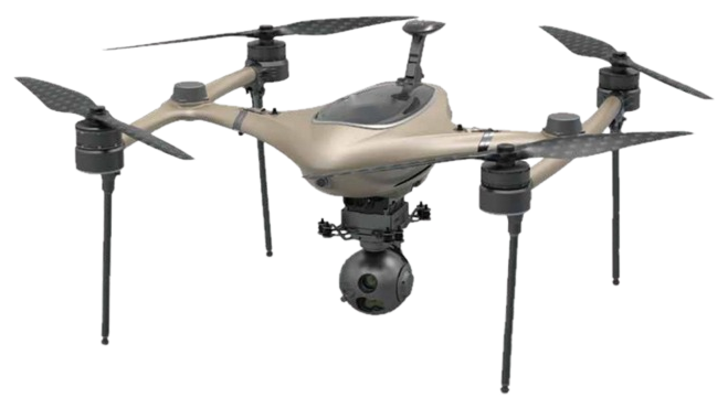
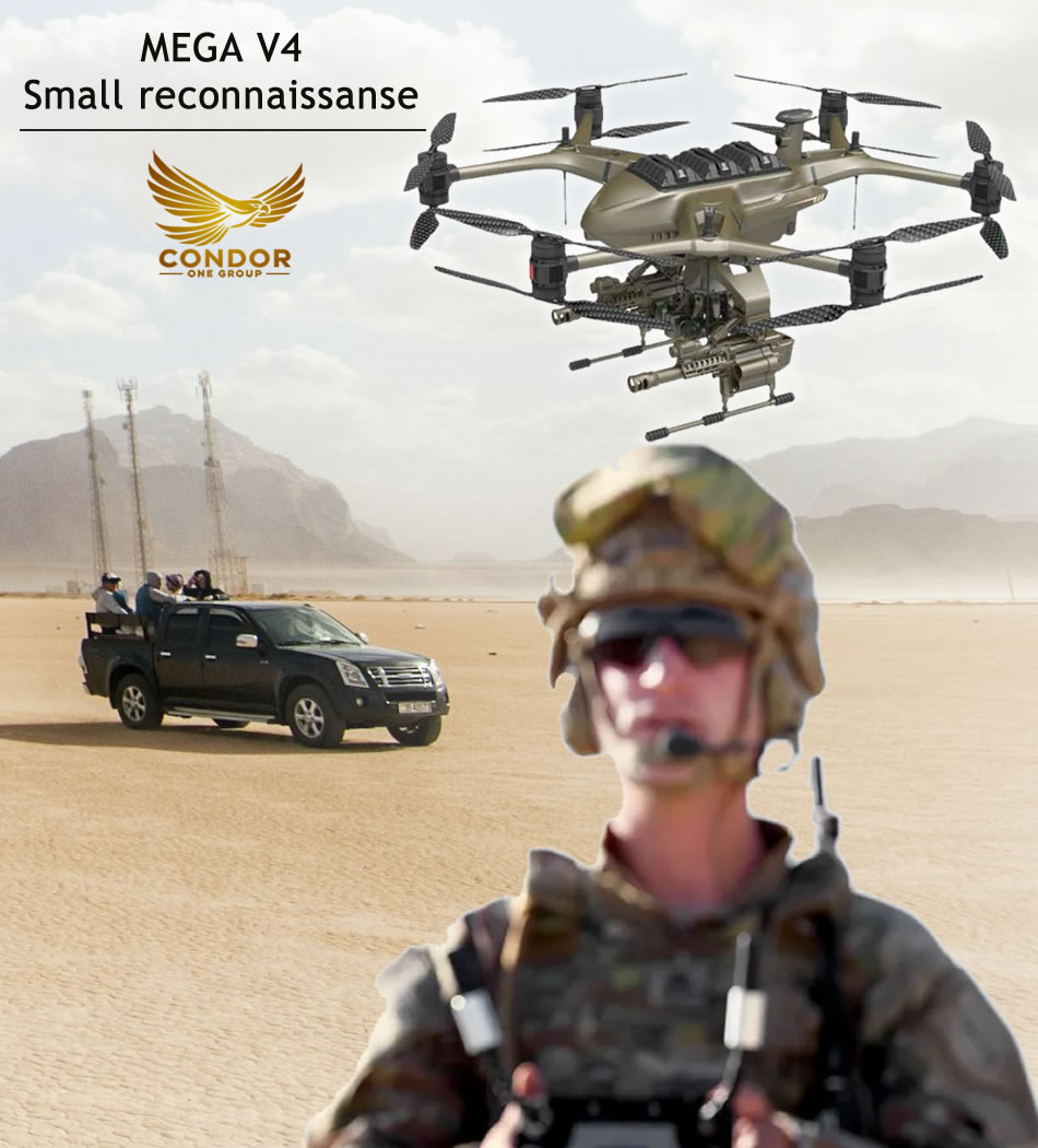
Drone Mega V4
Small reconnaissance drone
- Body size: 740mm × 725mm × 397mm
- Aircraft wheelbase: 900mm
- Battery life: < 45 minutes
- Maximum load: < 2kg
- Flight radius: < 5km
- Operating temperature: -40 ℃ ~ +85 ℃
- Disassembly and assembly time: < 2 minutes
- Power battery: 34000mAh
- Flight speed: < 14m/s
- Flight altitude: ≤ 3500m
- Wind resistance level: 5
- Protection level: IP55
- Positioning accuracy: Horizontal ± 1 meter, Vertical ± 2 meters
- Satellite positioning: Beidou, GPS, GLONASS, RTK, three-star seven-frequency
- Intelligent flight simulation, guided flight, guided mission, breakpoint continuation.
- AB point route and return, one-click takeoff and landing, one-click return, route planning.
- Multi-task management.
- Supports equipment upgrades such as navigation radar, low-altitude obstacle avoidance radar, low light/night vision, lost contact return, and precise point recognition.
MEGA–V4 small reconnaissance drone, flight power.
Adopting a quadcopter structure and a foldable fuselage, it has application functions such as reconnaissance and surveying. It can carry visible light, infrared, night vision, laser ranging and other visual task payloads, obtain high-definition image information from a long distance, lock and track targets, and has the ability to identify, lock and repeat fire.
Fans lift cameras can be mounted for geographic information data collection, 3D modeling, and tracking of terrain and landforms. The model supports single-machine or cluster operation in various complex terrains.
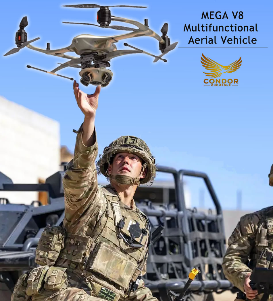
MEGA–V8
Multifunctional Aerial Vehicle
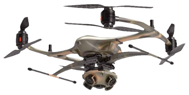
- Body size: 840mm × 990mm × 580mm
- Aircraft wheelbase: 1050mm
- Battery life: < 58 minutes
- Maximum load: < 6 kg
- Flight radius: < 15 km
- Operating temperature: -40 ℃ ~ +85 ℃
- Disassembly and assembly time: < 2 minutes
- Power battery: 34000mAh
- Flight speed: < 18 m/s
- Flight altitude: ≤ 5000 m
- Wind resistance level: 7
- Protection level: IP54
- Satellite positioning: Beidou, GPS, GLONASS, RTK, three-star seven-frequency
- Positioning accuracy: Horizontal ± 0.02 m, Vertical ± 0.05 m
- Intelligent flight simulation
- Guided flight, guided mission
- Breakpoint continuation
- AB point takeoff and landing
- One-click return
- Route planning
- Multi-task execution
- Integrated magnetic interference angle safety protection
- Low-altitude perception
- Lost contact return
- Precise base recognition
The MEGA–V8 multifunctional unmanned aerial vehicle uses an 8-rotor flight power system and a foldable tri-structure, with various application functions such as reconnaissance, surveying, support, shooting, and communication interception.
It can carry visible light, infrared, night vision, laser ranging and other visual task payloads, obtaining image information from a long distance and in high definition. It supports target recognition, locking and tracking.
It can be equipped with real-time lens lift cameras and SAR onboard geographic information positioning, 3D modeling, and terrain landform data.
The model also supports multi-function or terrain-based modules such as loudspeakers, sniffing and gas detection, flash bomb launchers, and lighting systems. It supports single or cluster operation in complex terrains.